Building walkability into new developments
Urban planners, local authorities and developers should work together to improve walkability in new developments to promote health and wellbeing and create sustainable and popular residential communities.
3 minutes to read
The events of 2020 have shone a spotlight not just on how we interact with our homes, but also the neighbourhoods where they are located.
The move to working from home has drawn attention to long commute times, while changing consumer behaviour is boosting the fortunes of local shops and businesses and the sense of community they can provide.
Therefore, could we also look back on 2020 as being a turning point for how we plan, design and deliver new large-scale developments?
Certainly, the arguments behind building mixed-use, mixed-income, walkable places appear to have been strengthened. This view is supported by the findings of a new report into sustainable development by The Prince’s Foundation, with partners Space Syntax, Knight Frank and Smart Growth Associates.
Among other findings, the report highlights the positive impact on communities from places that are planned to incorporate a mix of uses – be they residential, commercial, or community spaces. The findings suggest that greater quality of life, improved mental and physical health, and higher property values generally correlate with a higher level of “walkability” and more mixed-use in a range of areas throughout the UK.
Meeting ESG goals
There are wider societal and environmental benefits which can stem from creating walkable neighbourhoods too, a fact which is likely to be particularly relevant as the UK looks to set out a route map towards becoming a fully decarbonised nation.
Walkable places promote healthy, sociable and active lifestyles, as well as reduce dependency on cars. Given that transport is the single largest contributor to the UK’s carbon emissions, mixed use developments can help cut down on unnecessary journeys.
But what does ‘good’ look like?
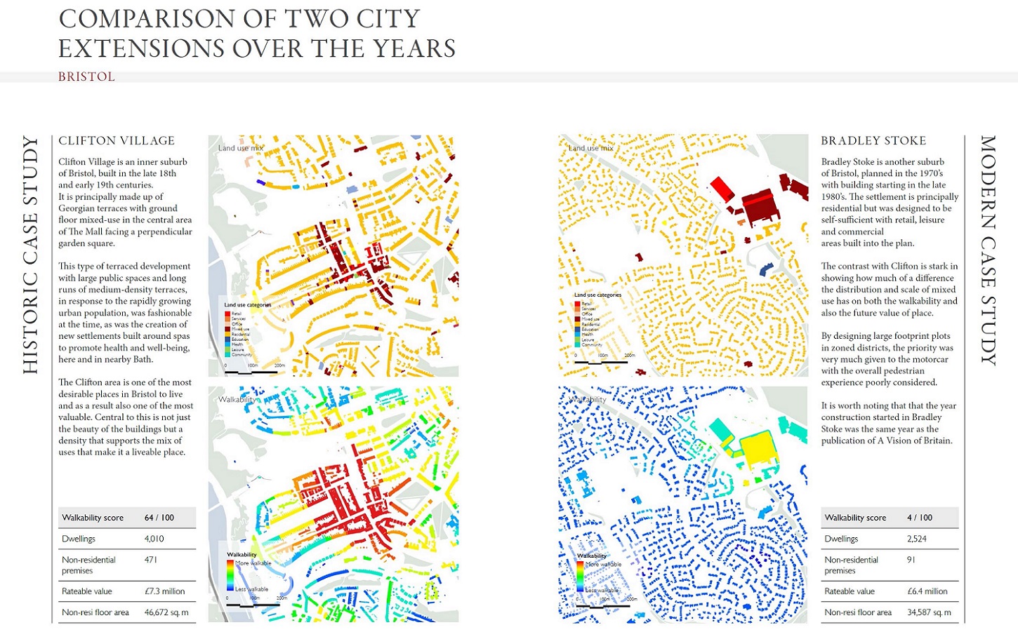
Computer modelling can map every-day, non-residential uses and then measure how far they are from people’s homes. The ‘Walkability’ heat maps in the report describe the degree to which newer settlements have succeeded, or not, to emulate the lessons of historical places. By analysing each building in turn, it is possible to identify how many different every-day land uses are within a 5-minute walk.
In the example below, Clifton Village scores highly through an organic integration of non-residential uses. Bradley Stoke, on the other hand, hosts a few, clustered retail uses in big boxes surrounded by car parks, which exemplifies the prevailing approach to residential development, which is a model of car-dependence.
Furthermore, the research concludes that there is a close correlation between the walkability of an area and its value. This shows that, for a given settlement’s context, if designers plan for greater walkability, then they can expect to drive greater mixed-use value.
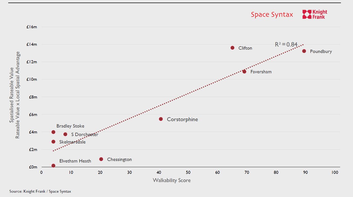
The highest scoring settlement is Poundbury, which has adopted a long-term stewardship approach to development. Charlie Dugdale, Knight Frank’s Head of Development Partnerships and a co-author of the report, highlights that Poundbury can now boast more jobs than homes, which has a hugely beneficial multiplier effect on the local economy.
The report concludes with a call for landowners to adopt a stewardship model for development, and for planners, designers, developers and policy makers to recognise walkability as an essential ingredient for successful new settlements.